 ← My Adventure Maps ← My Adventure Maps
Want both front & back printed?
Design one side first, then message us before checking out. We'll handle the rest & create a custom order link (+€10).
 Color
Color Terrain
 Colorful
 Relief
 Gray Canvas
 Light
Light WaterColor
 Cartoon
 TopoGraphy
 Dark
Dark Satellite
 NL Provinces
 Tonal
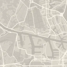
TonalOne color, with streets, water and parks as lighter and darker shades of it. Detail adapts to the zoom level.
White frame around the image, like a printed photo. Enable and adjust the size.
Toggle to highlight. Drag ⠀ to set layering order.
Shows the total distance traveled in each compass direction, across all visible activities.
Shows what time of day (in your local timezone) you were active, across all visible activities.
Upload images to overlay on your map.
Upload images to use as overlays or background.
The 'Social Media' size is completely free!
Want to win a physical print?
The best maps win a printed poster!
Click any text on the poster to move it. Corners change the size, the side handles where lines wrap. It snaps into line with everything around it.
Pin cities on your map, or add a highlight and drag it anywhere to mark memorable places. Click a highlight's icon to change it.
Add scannable QR codes to your design: link them to your Strava profile, your website, or anything else you'd like. Each one can be moved, resized, made see-through or deleted on its own.
No QR codes yet.
Drag a QR code on the map to move or resize it.



What you get:
You'll receive a 720p download link by email — perfect for sharing on social media.
Your details
This code gives you a completely free poster — no payment needed.
Checkout will open once your map finishes uploading.
Share this link to continue editing later. You'll need to reconnect Strava or re-upload your GPX, TCX or FIT files to reload your activities.
This social media download is completely free!
Want to win a physical print?
1️⃣ Follow us on Instagram: @my_adventure_maps
2️⃣ Tag us when you share your wrapped
3️⃣ The best maps win a printed poster!
You will be redirected to our payment provider shortly.
If nothing happens, click the button below to try again.
Enter your email and we'll send you a download link!
This lower resolution map is perfect for sharing on social media! Want a high-res version or print? Check out our premium options.
Your map is on its way to your inbox.
| Size | Chest width (cm) | Body length (cm) | Sleeve length (cm) |
|---|---|---|---|
| S | 45 | 69 | 20 |
| M | 50 | 72 | 21 |
| L | 55 | 74 | 22 |
| XL | 60 | 76 | 23 |
| 2XL | 65 | 78 | 24 |
How to measure:
Not available yet — we’re gauging interest before we build it.
What would you like to create? (you can change this inside the tool)
How do you want to load your activities?
Instantly load a marathon or popular route.
.gpx, .tcx or .fit

Import from Strava
No upload needed
Map for someone else
Here's how the tool works:
Extra
Questions, suggestions or wishes? Contact us!
For your privacy, activity data isn't stored in a saved link - only your design settings are. Reconnect below to load your activities back in.
.gpx, .tcx or .fit
Import from Strava
Like the viral glowing-route photo trend — made with our own tool, no AI required. Pick a route, then drop it onto your own photo.
Try it instantly, no account needed
Use your own routes
Your route is glowing and ready. Upload a photo and we'll drop it in as your background automatically.
JPG or PNG
Here's what you've been up to. Looks beautiful, right?
Incredible! Let's make it yours ✨